
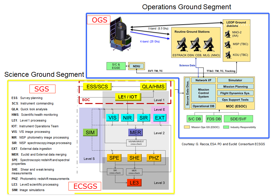
The Science Ground Segment
During the 6 years of the survey, Euclid will collect more more than 500,000 visible (VIS) and near infrared images (NISP imaging and NISP spectroscopy) that will be transferred to Earth on a daily basis cadence.
The Euclid space images will be complemented by visible imaging data from ground-based telescopes, covering the same sky as the Euclid mission, in order to derive photometric redshifts (distance measurements) of lensed sources. Euclid space and ground data will provide photometry of each galaxy in 7 different filters ranging from 460 nm to 2000 nm (g,r,i and z bands from the ground, Y, J and H from Euclid) down to 24.0 to 24.5 AB magnitude. Overall, the Euclid input images represent several million of images and about 30 Petabytes of image data.
In addition to the data volume one challenge of the science ground segment is to process and analyse heterogeneous data sets that mix together space and ground based images. They will be obtained with several telescopes providing visible or near infrared data with different depth and resolution in order to derive astrometric, photometric, morphometric and spectroscopic parameters of sources and possibly time domain information.
About 10 billion sources will be observed by Euclid, out of which more than 1 billion will be used for weak lensing, and about 30 million galaxy redshifts will be obtained. The science ground segment is a most challenging part of this mission and represents about 50% of the resources provided by the Euclid Consortium.
The ground segment activities are shared by ESA and the Euclid Consortium.
The Science Ground Segment (SGS) of the Euclid mission is composed of the combination of two independent sections: the ESA Science Operations Centre (SOC), and the Euclid Consortium Science Ground Segment (EC SGS). SOC will be the single interface to the ESA Mission Operations Centre (MOC), and hence to the Euclid Operations Ground Segment (OGS). The SOC is also in charge of the survey planning, managing the downlinked data (i.e. performing quick look, daily quality reports and telemetry editing) and providing the EC with the data necessary to perform further processing of the science data.
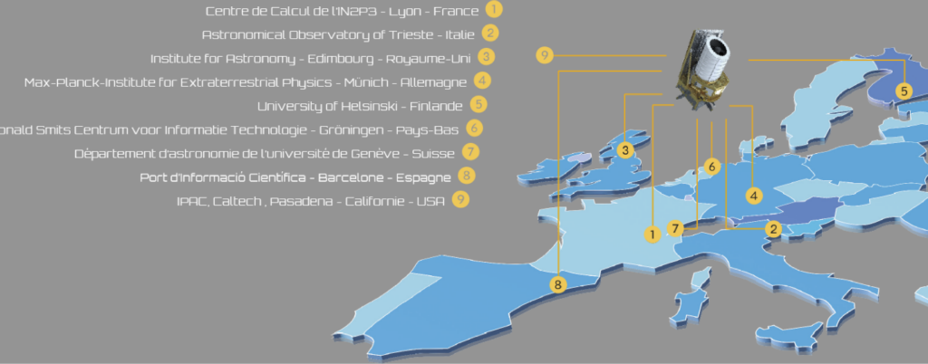
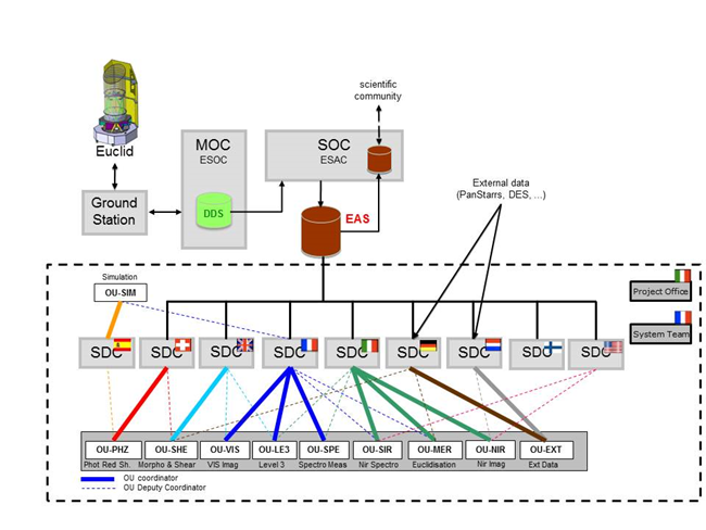
The scientific processing of the data, down to the production of the scientific results, is the responsibility of the Science Ground Segment managed by the Euclid Consortium. The processing activity will occur in national Science Data Centres (SDCs, see the figure below). Two SDCs will host the Instrument Operations Teams (IOTs), one for each of the instruments, which will perform the monitoring of instrument performance. Other SDCs will be in charge of providing large external data sets obtained from ground based surveys complementing the Euclid data.
The SGS will be designed consistently with the principle of maximising the impact of Euclid in both primary and legacy sciences. For this purpose, one of the drivers in the design will be making data available publicly as soon as possible. The SGS will therefore be responsible for the archive and the production of the official Euclid data releases.

Courtesy Euclid Consortium/ESA/SGS Team.
Courtesy Euclid Consortium/ESA/SGS Team.